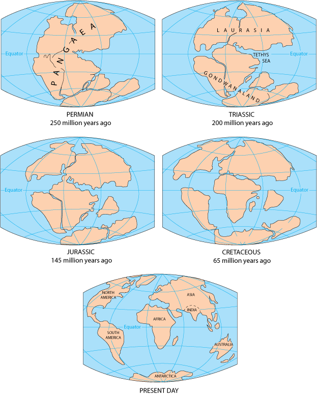
1912-Alfred Wegener was the first to advance the idea of mobile continents. He suggested that the continents were once one large landmass called Pangaea that was surrounded a giant ocean called Panthalassa.
1960-Sir Edward Bullard and two associates used a computer program to fit the continents together by using a depth of 2000 meters below sea level instead of using the shorelines.
1962-Harry Hess left his depth recorder on while he was traveling the sea and had extensive records of the ocean floor, from mountain ridges to narrow trenches of the ocean basins.
1963-Frederick Vine and Drummond Matthews combined the pattern of magnetic sea floor stripes with the idea of sea floor spreading
Wegener noted the similarities in rock sequences in countries across the Atlantic Ocean from each other, suggesting that mountains formed and then separated. In addition, there are many examples of plant and animal fossils in different continents that suggest that these organisms needed a specific environmental condition to survive, suggesting that the continents used to be connected.
After World War II, technology had developed that allowed scientists to study the way rocks retained the signature of Earth’s magnetic field. Scientists discovered that different areas had different magnetic magnetizations, but since there is only one north magnetic pole at any time and it is unlikely that its position has changed, it suggested that the pole remained stationary while the continents moved relative to the pole and to each other.
As a U.S. Navy officer, Harry Hess compiled his records of his depth recorder and suggested the idea of sea floor spreading, and this is confirmed by the existence of the mid-ocean ridge. The mid-ocean ridge has a spread center, where the ocean floor is split in two and carried away from the axis and replaced by volcanic material that fills the space and forms new sea floor.
In the late 1960s, deep-sea drilling occurred, and through testing the age of the rocks, it was confirmed that the sea floor had younger rocks near the mid-ocean ridge and the age would increase on either side of the ridge.
Occurrence of earthquakes also closely matches with the edges of plates, noting the interaction of plate boundaries.
This all led to the theory of plate tectonics, which describes the movement of the outermost portion of Earth and the associated continental and sea floor features. The tectonic plates are part of the lithosphere that float on the asthenosphere.
Paleogeography is the study of historical changes of continental shapes and position
